


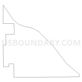
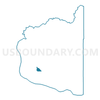
Voting District 565, Clark County, Washington
About
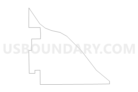
Outline
Summary
| Unique Area Identifier | 683960 |
| Name | Voting District 565 |
| County | Clark County |
| State | Washington |
| Area (square miles) | 1.42 |
| Land Area (square miles) | 1.42 |
| Water Area (square miles) | 0.00 |
| % of Land Area | 100.00 |
| % of Water Area | 0.00 |
| Latitude of the Internal Point | 45.69029650 |
| Longtitude of the Internal Point | -122.61660120 |
Maps

Graphs
Select a template below for downloading or customizing gragh for Voting District 565, Clark County, Washington


Neighbors
Neighoring Voting District (by Name) Neighboring Voting District on the Map
- Voting District 325, Clark County, WA
- Voting District 330, Clark County, WA
- Voting District 360, Clark County, WA
- Voting District 424, Clark County, WA
- Voting District 425, Clark County, WA
- Voting District 426, Clark County, WA
- Voting District 434, Clark County, WA
- Voting District 435, Clark County, WA
- Voting District 560, Clark County, WA
- Voting District 563, Clark County, WA
- Voting District 638, Clark County, WA
- Voting District 642, Clark County, WA
Top 10 Neighboring County Subdivision (by Population) Neighboring County Subdivision on the Map
Top 10 Neighboring Place (by Population) Neighboring Place on the Map
- Salmon Creek CDP, WA (19,686)
- Hazel Dell CDP, WA (19,435)
- Five Corners CDP, WA (18,159)
- Walnut Grove CDP, WA (9,790)
- Barberton CDP, WA (5,661)
Top 10 Neighboring Unified School District (by Population) Neighboring Unified School District on the Map
- Vancouver Public Schools, WA (142,811)
- Evergreen School District (Clark), WA (139,009)
- Battle Ground School District, WA (65,182)
Top 10 Neighboring State Legislative District Lower Chamber (by Population) Neighboring State Legislative District Lower Chamber on the Map
Top 10 Neighboring State Legislative District Upper Chamber (by Population) Neighboring State Legislative District Upper Chamber on the Map
Top 10 Neighboring 111th Congressional District (by Population) Neighboring 111th Congressional District on the Map
Top 10 Neighboring Census Tract (by Population) Neighboring Census Tract on the Map
- Census Tract 408.09, Clark County, WA (6,176)
- Census Tract 408.05, Clark County, WA (5,735)
- Census Tract 408.03, Clark County, WA (5,035)
- Census Tract 408.06, Clark County, WA (4,611)
- Census Tract 408.10, Clark County, WA (2,728)
- Census Tract 408.08, Clark County, WA (1,605)